- home
- services
- subsea cable survey
subsea cable survey
Our announcement page keeps you up-to-date on our latest projects, research breakthroughs, partnerships, and industry events.
Accurate Fault Detection and Cable Assessment
Our non-intrusive geophysical methods provide reliable data on cable integrity, pinpointing issues such as cuts, short circuits, and sheath damage.
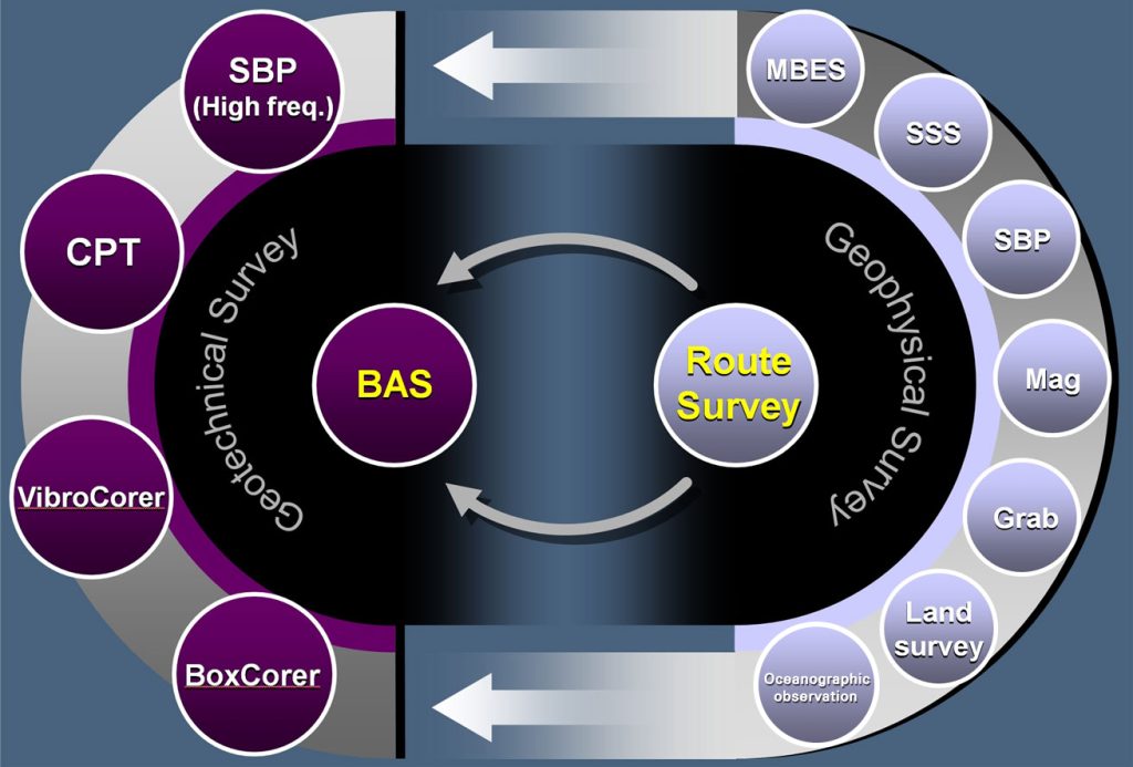
Flow chart of the progress report
Precision-Driven Insights from Route Selection to Installation Management
key features
- Optimal Route Selection: Conduct detailed investigations to select the safest and most cost-effective route, using BAS analysis as a foundational resource.
- Simultaneous Geophysical and Geotechnical Surveys: Perform integrated ground environment surveys to provide a complete assessment of route conditions.
- Geophysical Survey Capabilities: High and low-frequency stratigraphic surveys, high-resolution bathymetry (MBES), seabed imaging (SSS), and physical oceanographic observations.
- Geotechnical Survey Techniques: CPT testing, vibratory core drilling, and Box Corer sampling for comprehensive ground characterization.
- Integrated Data Analysis: Link geophysical and geotechnical data for a full understanding of ground properties across the entire route.
- Feasibility and Constructability Assessment: Provide clear, data-driven insights for subsea cable and pipeline projects, as well as offshore wind farm development, ensuring safety and efficiency.
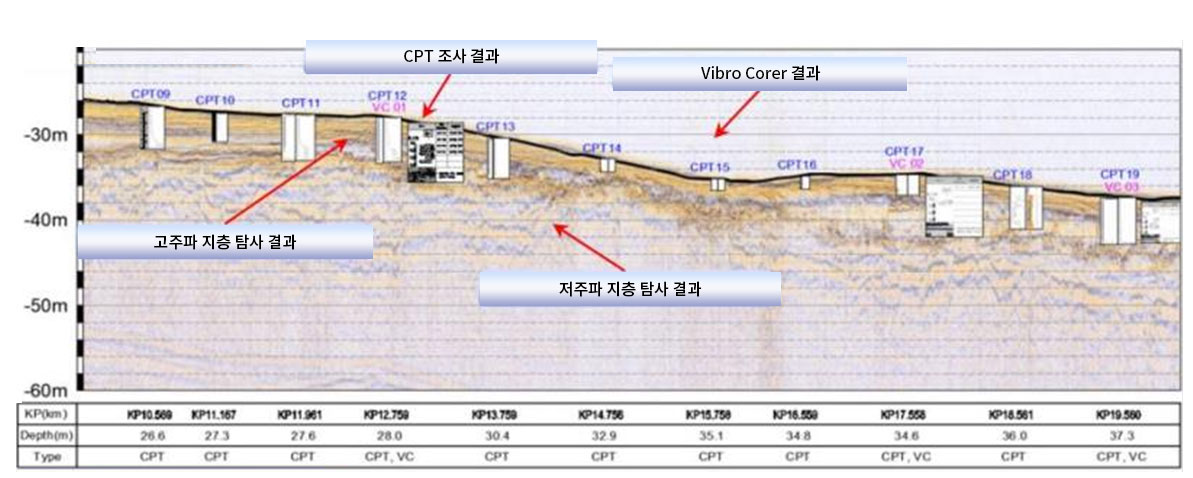
Research Data Synthesis
Comprehensive analysis and integration of survey data to create a cohesive understanding of geophysical and geotechnical findings, supporting accurate and informed project decisions.
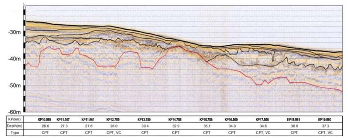
Acoustic Stratigraphic Classification
The categorization of seabed layers using acoustic signals to identify and differentiate various geological strata, providing crucial insights for route planning and construction.
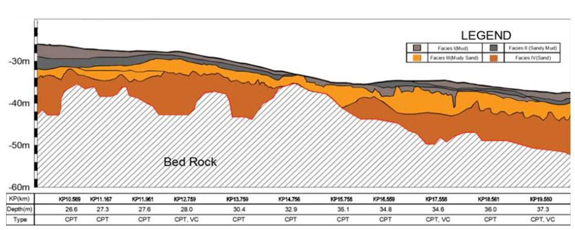
Isolayer Thickness According to Medium
Measurement of the thickness of specific geological layers, adjusted based on the characteristics of the surrounding medium, to aid in accurate ground profiling.
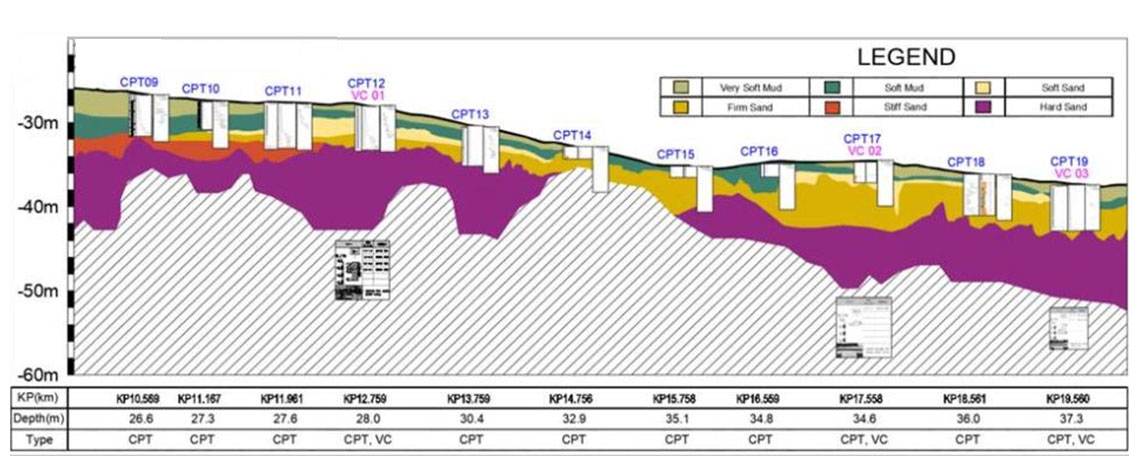
Isolayer Thickness Reflecting Material Properties
Assessment of layer thickness that accounts for the physical and mechanical properties of different materials, ensuring data precision for engineering applications.

Submarine Cable Burial Depth Measurement
Accurate determination of how deeply submarine cables are buried in the seabed, ensuring cable protection and compliance with environmental and safety standards
Trust GeoView to be your partner in exploration, helping you unlock potential, mitigate risks, and drive success in every project.
Safety
First
Prioritizing safety in every operation to protect people and the environment.
Reliable
Data
Delivering accurate and trustworthy geospatial insights for confident decision-making.
Wide Range of Versatile Assets
Equipped with adaptable tools to meet diverse project needs efficiently.

